Blog
Article List Home My Research Services Contact Me
|
Wilkes May 2, 2022 Hughes Bottom on the Yadkin As North Carolina was being settled
from east to west, the most popular area in the vicinity of Surry and Wilkes
County was along the Yadkin River for obvious reasons. There was a plentiful supply of water and
fertile soil for growing crops. And
the land along the river was flat enough that it was easier to construct
roads or use existing paths. In 1752, Edward Hughes purchased 314
acres in what was then Anson County on the north side of the Yadkin
River. When it was surveyed in 1749,
the land was known as "Fairfield", but it was later referred to as
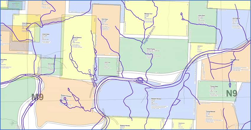
"Hughes Bottom". The branch
that runs through the property is still called Hughes Branch as a legacy of
the original landowner. It's on the
east side of Ronda, with Hwy 268 running through the middle of it.
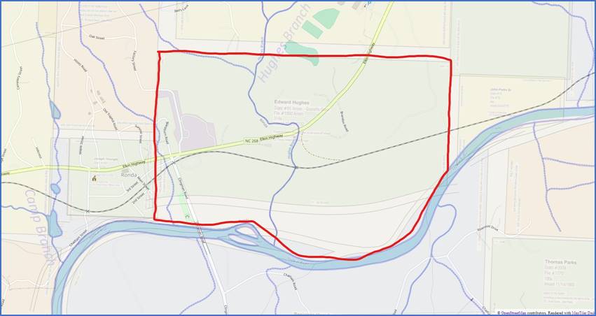
The Hughes Bottom tract is
on the north side of the Yadkin River, centered in the image above. Edward Hughes likely never lived
here. He seems to have been a land
speculator who invested in property that he knew would soon increase in
value. He owned several large tracts
scattered between Salisbury and Wilkesboro.
He sold this property in 1763 to John Howard, and by that time this
part of the state had become Rowan County.
Mr. Howard only kept the land for four years, selling it to John
Mitchell in 1767.
The Hughes Bottom tract is
shown above in green on Hughes Branch. Land records were sometimes
inconsistent during the Revolutionary War, but eventually Hughes Bottom ended
up in the hands of William Powe. In
1792 Powe sold it to Richard Gwyn, and it remained in the Gwyn family for
over a hundred years. This Richard Gwyn
(1765-1822) was the uncle of the man by the same name who started the grist and
cotton mills in Elkin in the 1840s.
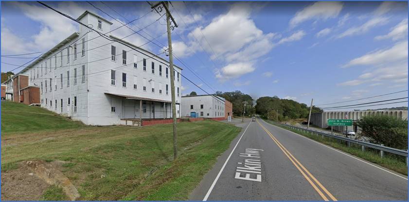
Looking east along Hwy 268
from the western end of the Hughes Bottom tract. The building in the photo is on Factory
Street at the western end of the Hughes Bottom tract. That’s the old Chair Factory building. Moving northeast along Hwy 268 through the
property, the northern boundary is just below East Wilkes High School. This is a link to the area on Google Maps.
Comment below or send an email - jason@webjmd.com |