Blog
Article List Home My Research Services Contact Me
|
Surry January 14, 2022 The Rock Wall Growing up, I was always intrigued by the
old rock wall behind the Elkin Public Library. I knew an old building had stood there long
ago, but I didn’t know much else about it. I had no idea how much fascinating history had
occurred in that one location over the past 250 years. It’s served as the site of a saw mill, iron
furnace, grist mill, and cotton factory.
There was even a major road that forded the creek here for a century
before a bridge was finally built. It’s
fitting that the library is located here at the same location where so many
industries got their start, laying the foundation for the establishment of
the town of Elkin.
The rock wall behind the Elkin
Library. I’ve written a lot about David Allen
who owned the first business on the Big Elkin, and that information can be
found here. The short version is that he operated a saw
mill here before 1768 when he is first mentioned in the Moravian records. By 1773 he had transitioned to an iron
mining and smelting operation despite that being declared illegal by the
British government. Several surrounding
iron works – including some in South Carolina – were destroyed by the British
during the Revolutionary War, but David Allen’s operation continued
production throughout the war. He operated
a furnace on the east bank of the creek until he sold all of his 2,482
acres in 1786. The iron works likely
continued to operate until about 1800.
In 1809, a road order referred to it as “the old iron works” which
suggests that it was no longer in operation at the time. During the following decades the iron
works property exchanged hands several times, sometimes as a result of a
court order that required the owner to sell it to pay debts. Some of these owners and temporary trustees
included Jonathan Haines, William Green, William D. Kelly, and Henry G.
Hampton. It doesn’t appear that
anything was done with the property in the early 1800s. By 1838, a man living across the Yadkin
River in Jonesville must have seen potential in the old iron works
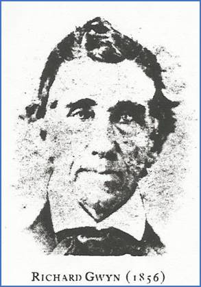
property. On January 23, 1839,
43-year-old Richard Gwyn bought the original 640-acre property from Richard
H. Parks for $2,000. Within a couple
years he built a grist mill at the exact same location where the old iron
works had been. Perhaps if there were
any remaining structures from that operation, those building materials might
have been repurposed to construct his mill.
Richard Gwyn in 1856 –
from findagrave.com According to Jason Couch’s book “Images
of America – Elkin”, Richard Gwyn added a cotton mill to the operation in
1847 and formed Elkin Manufacturing Company.
The water that powered these operations came from a dam that was located
where the Market St. bridge is today.
A flume carried the water about 400 feet downstream in much the same way
that it had 70 years earlier for David Allen’s iron works.
Elkin Manufacturing Company
12.6-acre tract in 1857. Click on the photos to view a larger
version in a separate tab. In 1857 Richard Gwyn sold three
quarters of his interest in Elkin Manufacturing Company to Litle Hickerson
and James Gwyn (one fourth jointly), Richard R. Gwyn (one fourth), and Columbus
B. Franklin (one fourth). The property
was 12.6 acres. During the Civil War,
Northern troops visited the factory, but Gwyn and his associates successfully
persuaded them not to do any damage. His
operation escaped the war unscathed just as David Allen’s iron works had
during the Revolutionary War 80 years earlier.
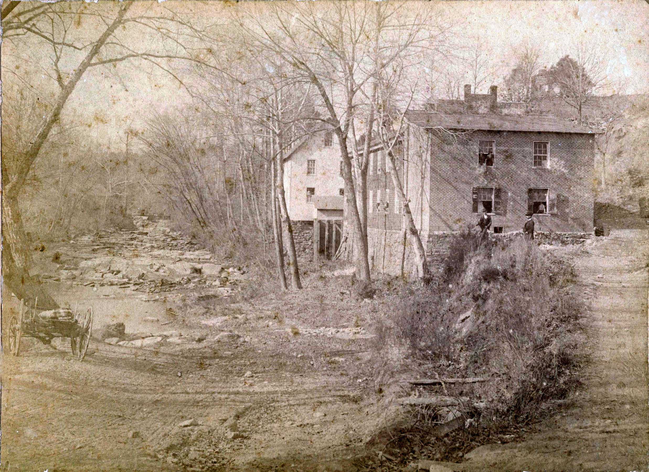
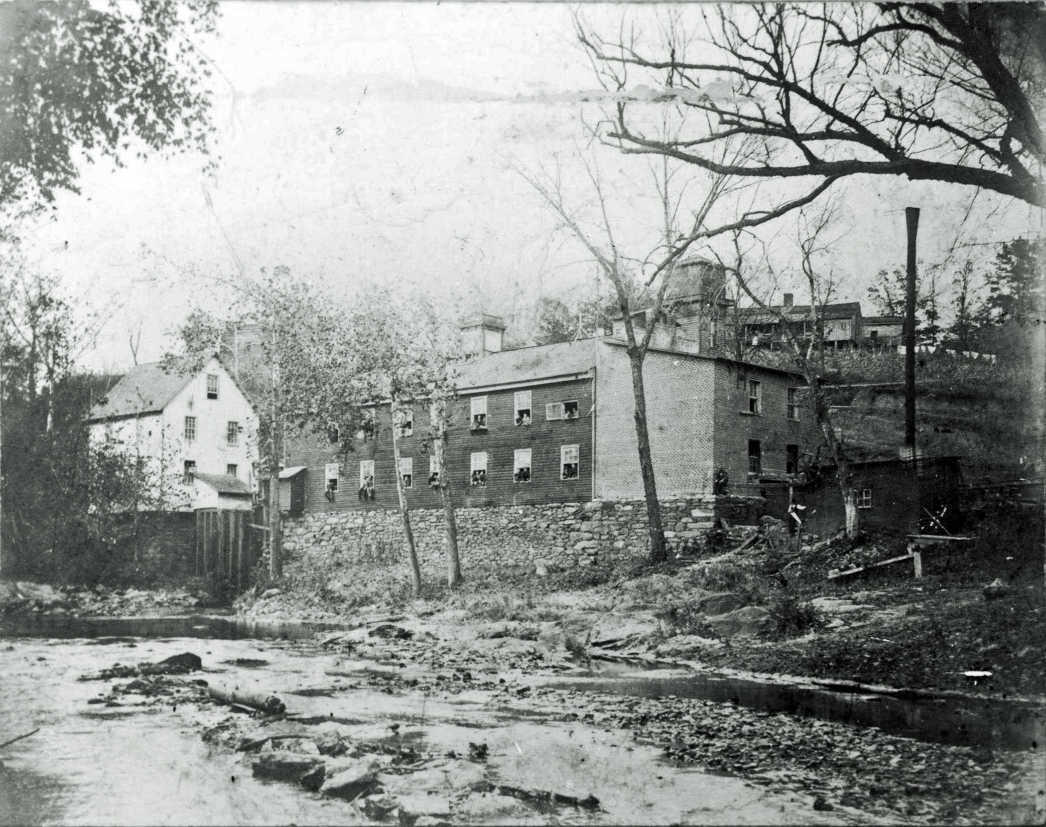
Photo 1: Looking northwest up the creek with the
cotton mill and grist mill on the east bank.
Taken c1880 per a note on
the back. Part of the Elkin
Historical Collection. Even though the photo above was taken about
1880, this is probably similar to the way it looked when invading troops
approached after crossing the Yadkin River during the Civil War. The wagon in the foreground is parked by
the side of the road where it forded the creek.
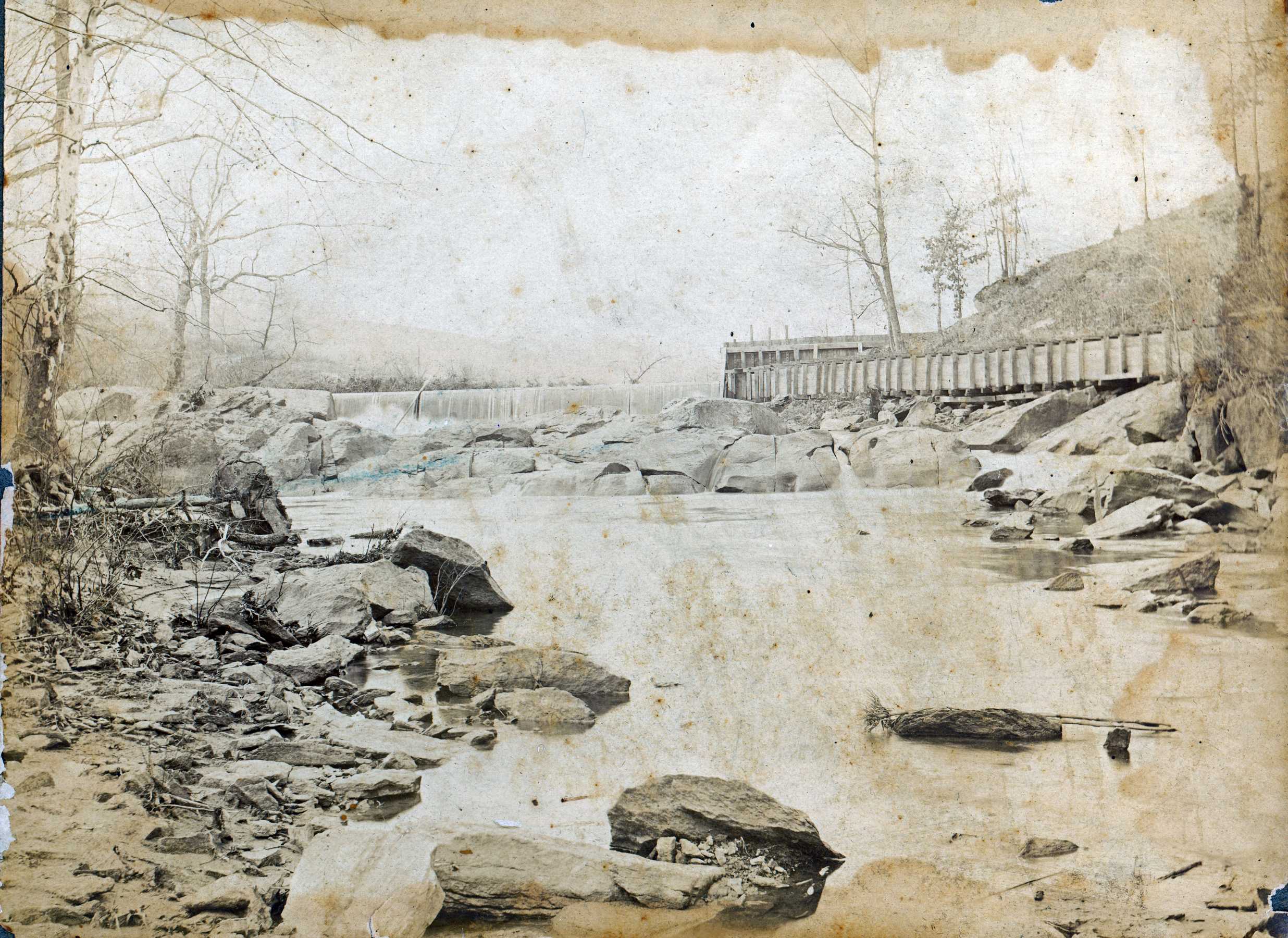
Photo 2: The dam and flume in the late 1800s. Part of the Elkin Historical Collection. In the photo above, the dam is seen beyond
the boulders with water flowing over the top.
The flume is at the right, carrying water to the mills. This dam was located a few feet north of where
the Market St. bridge is today.
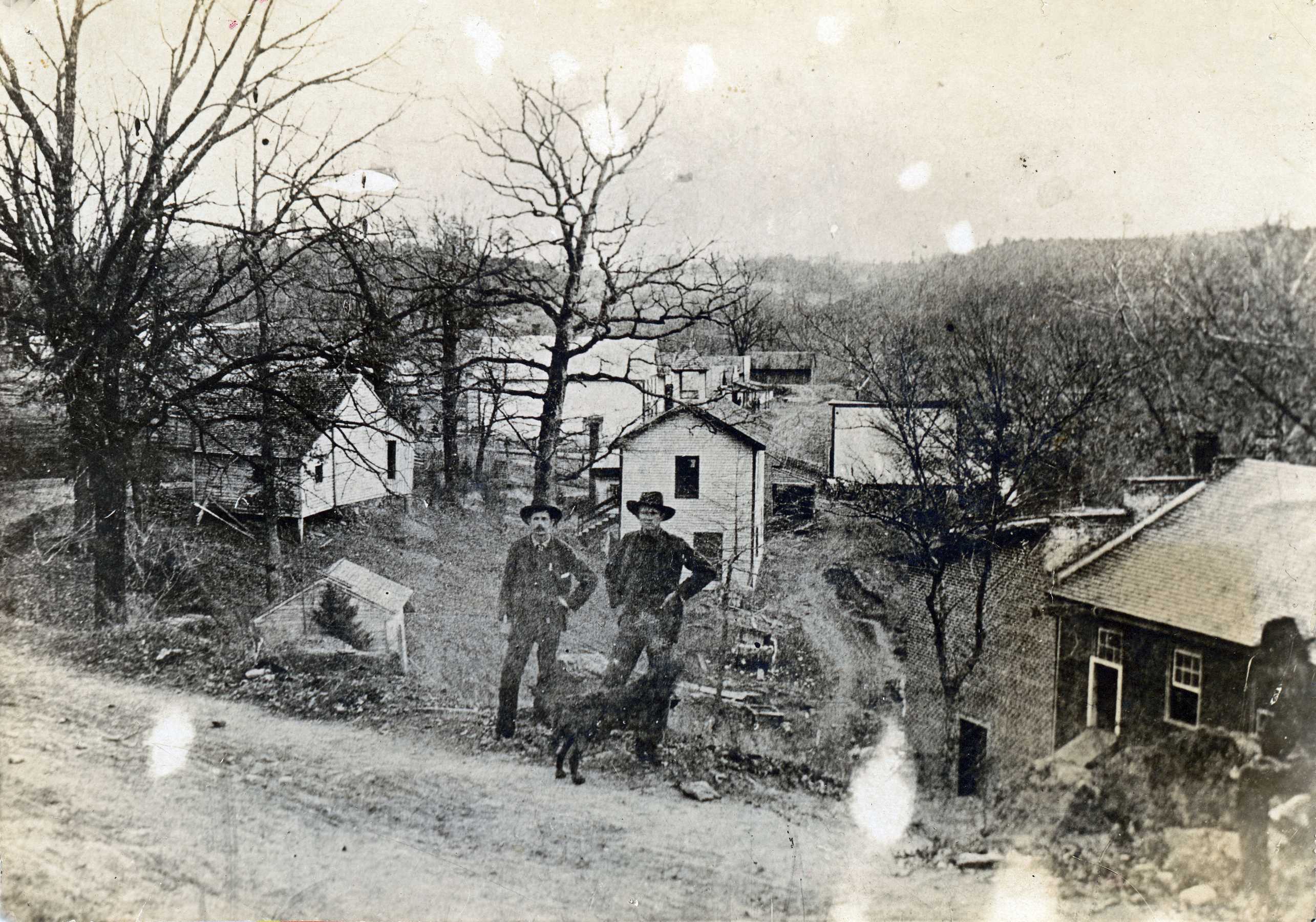
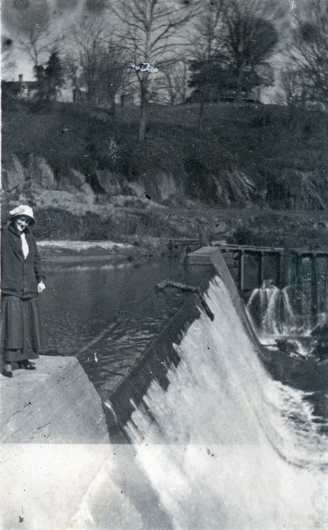
Photo 3: Two men standing with their dog on the east
side of the cotton factory c1890. Part of the Elkin
Historical Collection. Photo 3 is the only photo that shows
the side of the factory that faces east toward the road. It’s the building in the lower right,
identified by the brick addition with the sloped roof on the south end. In later photos, an elevator shaft can be
seen protruding from the roof of the cotton factory, but that isn’t seen
here. (I wonder when the elevator was
added?) The men are standing on what
today is Front St. near where the drive leads to the parking area under the
library. The white building directly
behind the men seems to have a belfry on top, so perhaps it was a church or school. That building is very close to where the front
door of the library is.
Photo 4: This photo appeared in the 3/18/1948
edition of The Tribune on page 6 of section 2. It was provided to the
paper by Clifford Everidge of Jonesville who said that it was taken in 1895. Part of the Elkin
Historical Collection. The photo above shows the grist mill
building (left) and the cotton mill (right).
The 1948 newspaper caption said that the brick portion at the right
was still standing and that it was used by Duke Power. Much of the rock wall foundation is still
visible along the bank of the creek. I
made a short video
that superimposes this photo on the rock wall of today. After close inspection, the individual
rocks from this 1895 photo can still be identified.
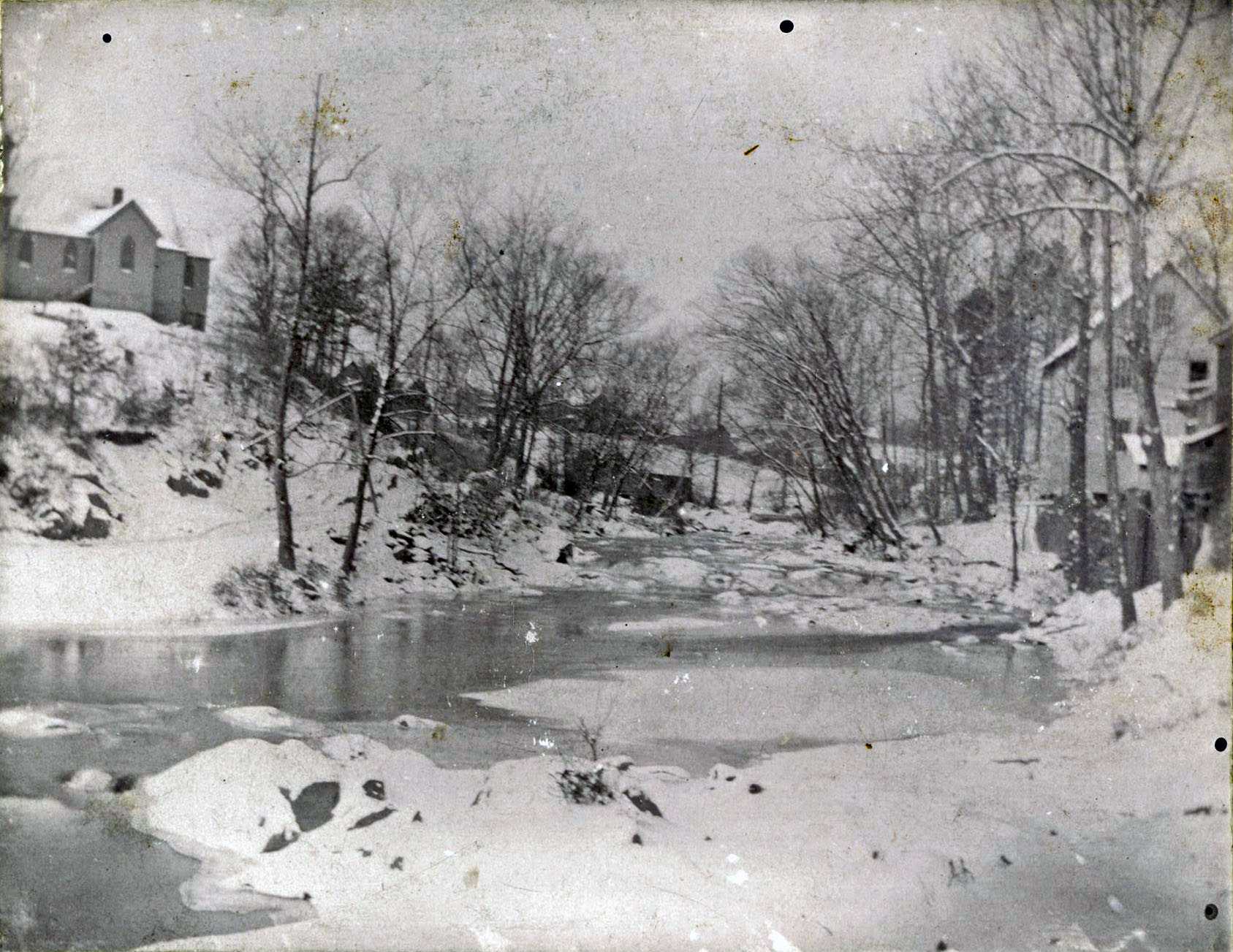
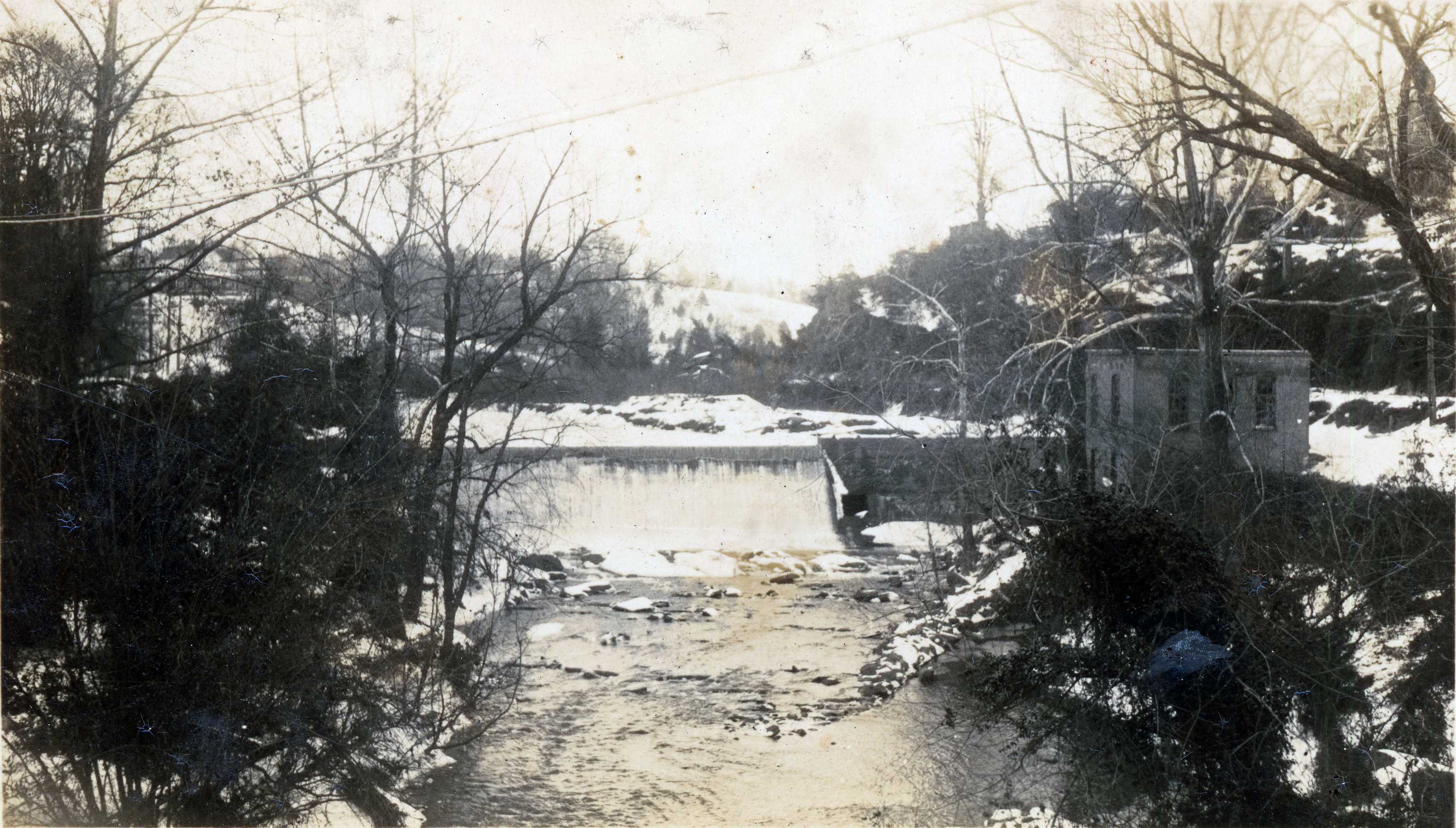
Photo 5: Looking northwest up the frozen Big Elkin
Creek c1900. Part of the Elkin
Historical Collection. Above, Galloway Episcopal Church is on
the hill at the left above the old Elk Spur Road that forded the creek. The grist mill building is at the right,
and the corner of the cotton mill can barely be seen beside it at the edge of
the photo.
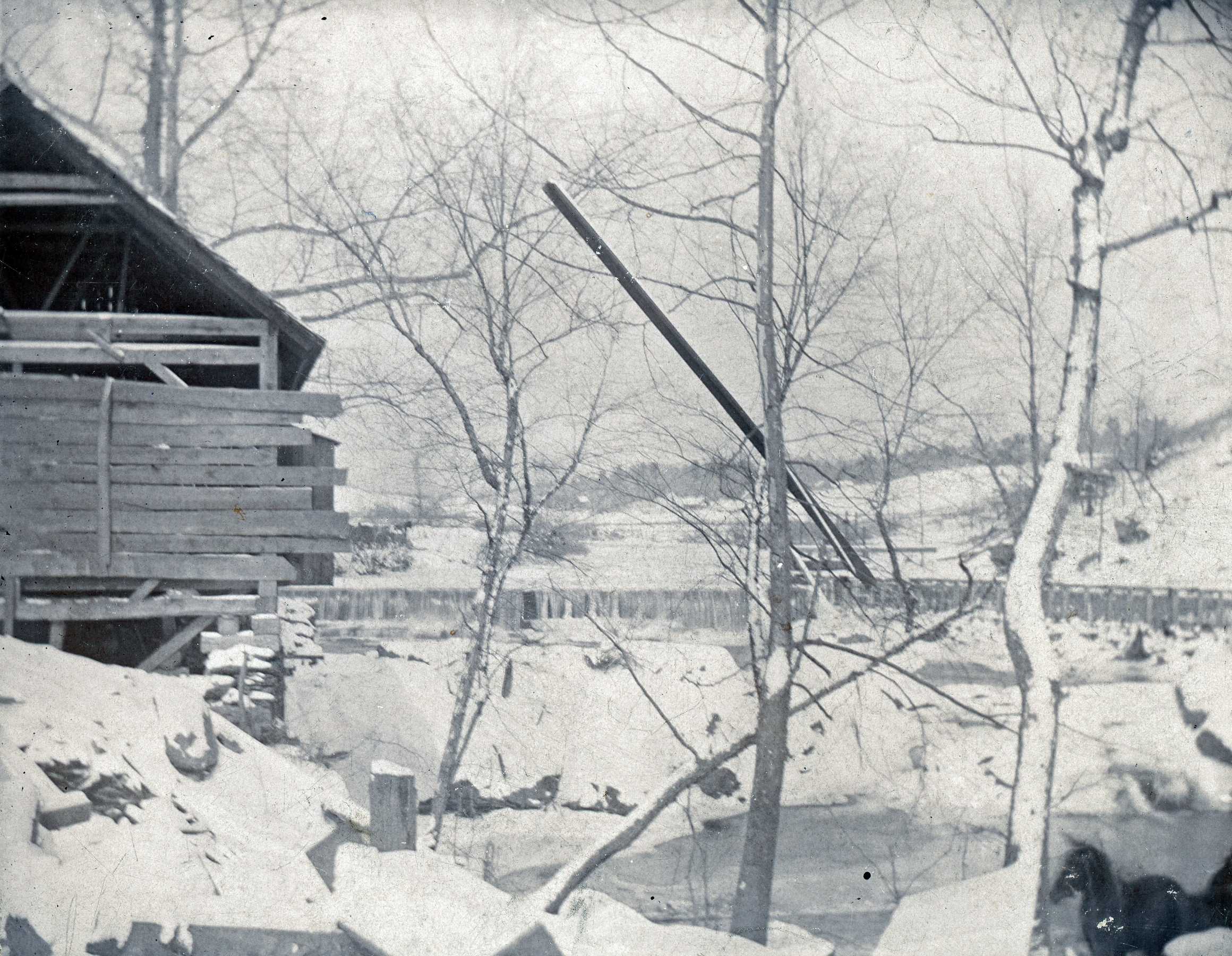
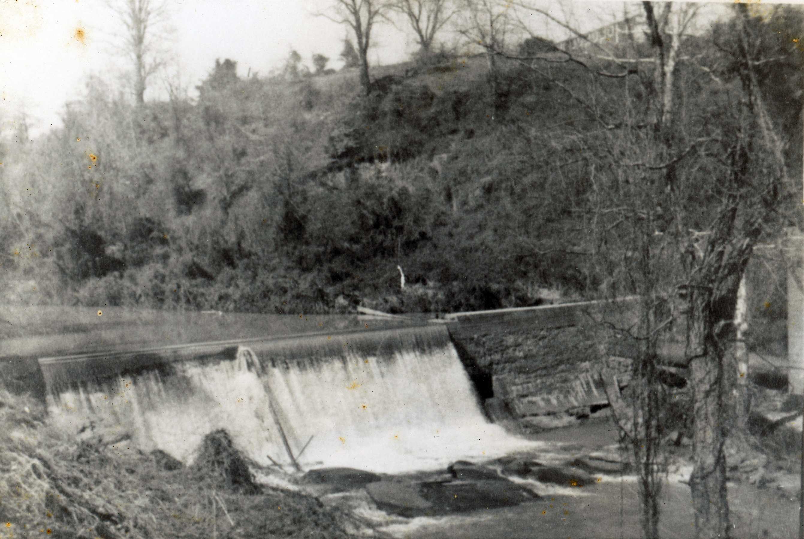
Photo 6: Dam and flume c1900. Part of the Elkin Historical Collection. Perhaps photo 6 was taken during the
same snow as photo 5. The camera is
positioned on the hill, perhaps near Galloway Church. The dam is in the center with the flume
extends downstream to the right.
Behind the dam, a large area that is dry land today would have been
under water back then. The northern
section of Front St. that runs up to the fire station was not a road then
because it was likely under water. The
lower end of the park and perhaps even part of Memorial Park Dr would have
also been submerged because of the higher water level caused by the dam. As mentioned before, this dam was near where
the Market St. bridge is today.
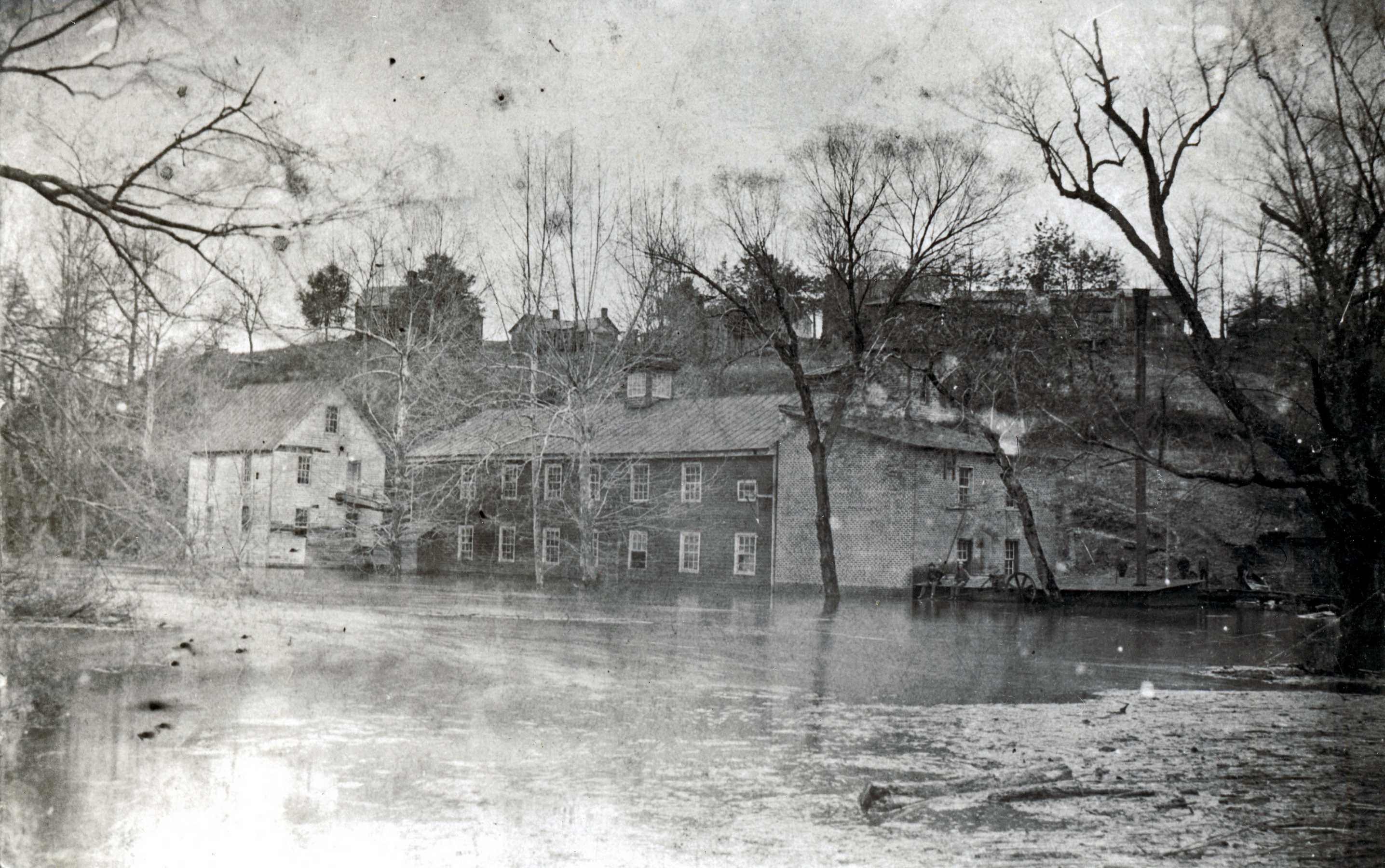
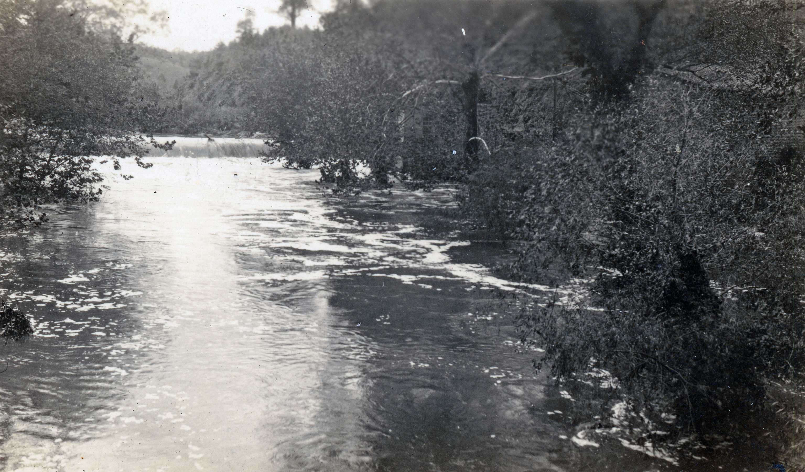
Photo 7: Grist mill and cotton mill during a flood, perhaps
c1900. Part of the Elkin Historical
Collection. The photo above must have been taken
before the new concrete dam was built in 1910. The dam extended eastward into where the
grist mill stood, so this oldest building had to be torn down before the dam
was constructed. The hill beyond the
factory is where Elkin Primary School is today. A road, called the Factory Road, led down
that hillside from the Old Virginia State Road to the front of the mill.
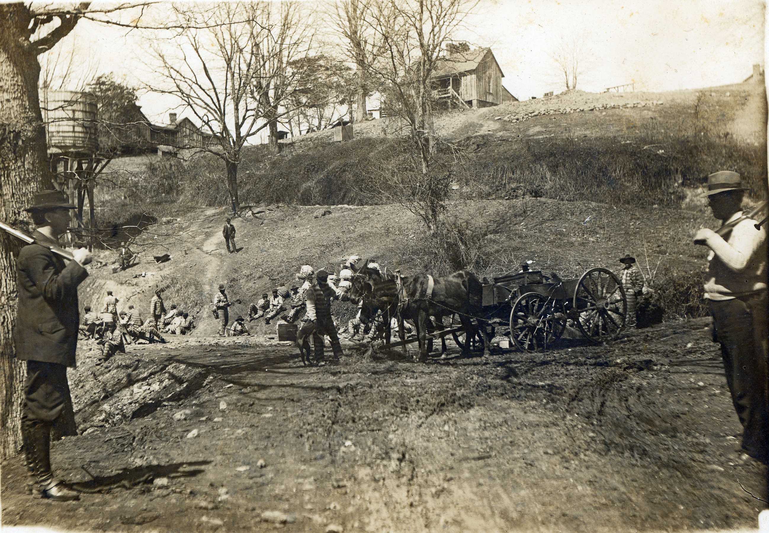
Photo 8: Convicts clearing the way for the new
E&A Railroad, 1908. Part of the
Elkin Historical Collection. The photo above shows two guards on
either side of Front St. in front of where the library is now. The workers, or prisoners, are congregrated
along the future path of the railroad.
The road beyond them, leading up the hill is the old Factory Road that
connected the factory to the Old Virginia State Road. In one deed from the mid 1800s, this old state
road was referred to as the road leading from Salisbury to Wytheville.
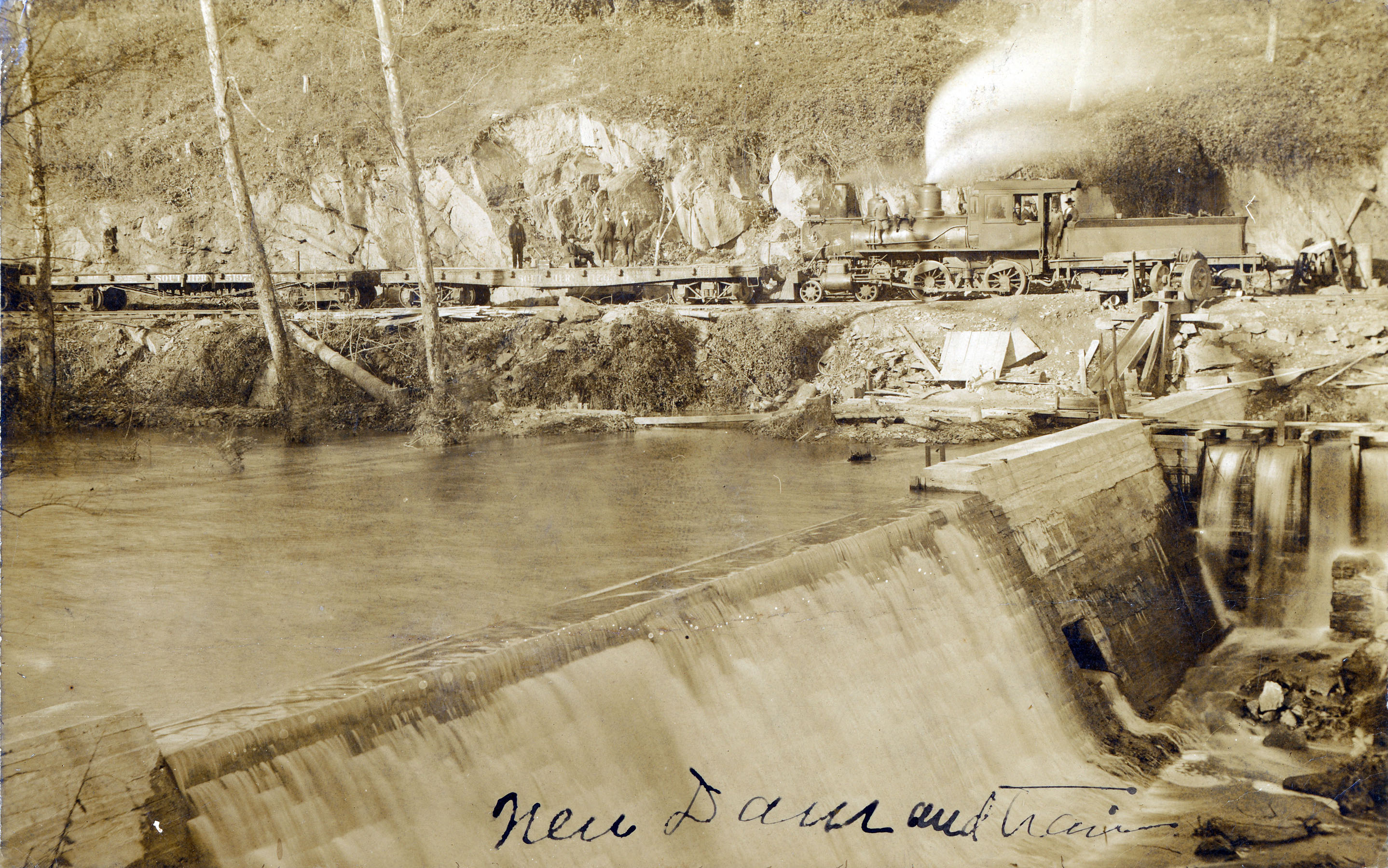
Photo 9: The new 1910 concrete dam in 1911. Part of the Elkin Historical Collection. When the dam was constructed, the old grist
mill had to be torn down. It was
previously located at the right of the above photo between the bank of the
creek and the railroad. Opening day of
the first section of the railroad was July 4, 1911.
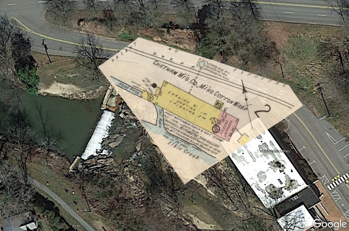
Photo 10: Portion of the 1915 Sanborn fire map on a satellite
view from Google Earth. This portion of the Sanborn map is
located and scaled to exactly match the remaining portion of the rock wall
that was the building’s foundation.
The yellow shaded portion was a frame building used for carding and sorting
on the first floor, and spinning on the second floor. The red shaded portion was a brick addition
labeled “pickers lappers”. While the
grist mill building is gone in 1915, the cotton mill building was still being
used. This 12.6-acre property (shown earlier)
was sold by Richard R. Gwyn and the Elkin Manufactuing Co to Chatham
Manufacturing Co in 1902. The path of
the E&A Railroad is also shown, and it matches the path of Front St.
today.
Photos 11 and 12: Two family photos show the new 1910 dam, taken
between 1915 and 1925. Roth family collection. Two family photos show the new concrete
dam and the east bank of the creek.
The race can be seen running left to right from the dam along the
railroad bed above. The grist mill building
is gone, and it’s not clear if the cotton mill is still there. If it still existed when this photo was
taken, it might be just beyond the right side of the photos.
Photo 13: Dam at high water, between 1910 and 1950. Roth family collection. The above photo is believed to be the 1910
concrete dam on the Big Elkin, but it’s hard to be sure. If so, then it’s during a flood because the
downstream water is extra high. The
old Elk Spur Rd is in the background on the west side of the creek. The camera angle doesn’t show if there are
any structures on the east side of the creek.
Photo 14: Concrete dam between 1911 and 1940. Part of the Elkin Historical Collection. The above photo shows the dam as viewed
from the old Elk Spur Rd. The square
hole on the right side of the dam is a useful marker in identifying it. At the far right, the edge of a brick
building is barely visible. Cotton
Mill Hill, where the Elkin Primary School is today, is in the background.
Photo 15: View of the dam possibly from the W. Main
St. bridge, between 1911 and 1950. Roth family collection. Photo 15 might have been taken from the
W. Main St. bridge. At the right, a
new brick building is visible. Several
people have commented that this building was the power plant. I don’t know when the old cotton mill was
torn down and this new brick building was constructed, but perhaps it was in
the 1940s.
Photo 16: View of the dam during a flood, between 1911
and 1950. Roth family collection. The brick power plant can barely be
seen through the trees, just to the right of the dam. Perhaps this was the 1940 flood that did so
much damage to downtown Elkin. Or,
this might have been a smaller flood during the 1930s or 1940s.
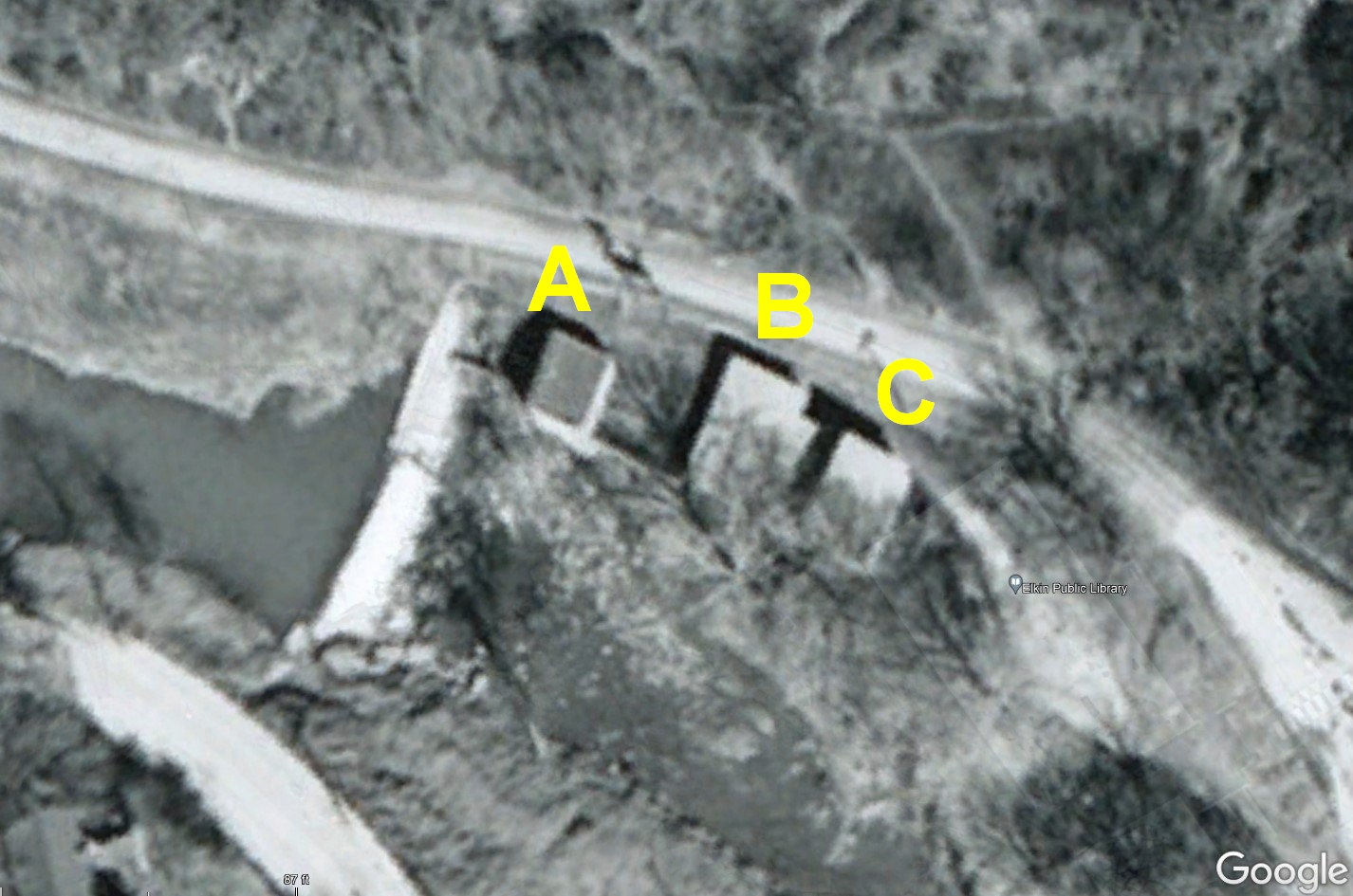
Photo 17: 1956 aerial photo of the dam. Part of the Elkin Historical Collection. This 1956 photo shows the power plant
(A) and the original brick addition to the cotton mill (C). The identity and
purpose of Building (B) is unknown. In
1956, the E&A Railroad was no longer in use, and this section of railway
had likely been turned into an extension of Front St. by this time. The lower end of Elk Spur St. can be see at
the lower left, and today this is part of the Overmountain Victory Trail. These three buildings would need to be torn
down before the library was built in 1969.
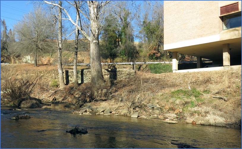
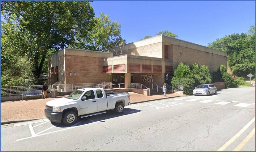
Photo 18: Elkin Public Library today. A lot of history has been made where the
Elkin Public Library sits today, and we’re fortunate to have these photos to
help tell the story. If I’ve made any
mistakes, let me know and I’ll make corrections. If anyone has other photos of this area, please share them! There’s still more to be learned about the
history that has occurred here over the past 250 years and every old document
and photo adds another exciting layer to the story.
Comment below or send an email - jason@webjmd.com |